
Eiterfeld topographic map
Interactive map
Click on the map to display elevation.
About this map
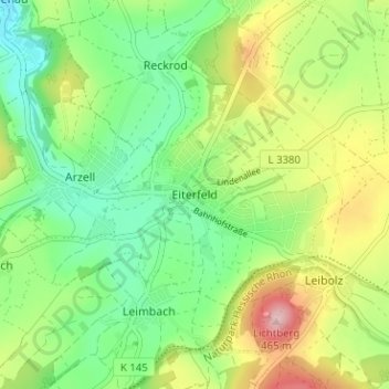
Name: Eiterfeld topographic map, elevation, terrain.
Location: Eiterfeld, Landkreis Fulda, Hessen, 36132, Deutschland (50.74183 9.77975 50.78183 9.81975)
Average elevation: 340 m
Minimum elevation: 262 m
Maximum elevation: 472 m