
Layland topographic map
Click on the map to display elevation.
About this map
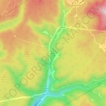
Name: Layland topographic map, elevation, terrain.
Location: Layland, Fayette County, West Virginia, United States (37.86928 -80.99121 37.90928 -80.95121)
Average elevation: 831 m
Minimum elevation: 597 m
Maximum elevation: 1,033 m
Other topographic maps
Click on a map to view its topography, its elevation and its terrain.
New River Gorge National Park and Preserve
United States > West Virginia > Fayette County > Oak Hill
Average elevation: 694 m
New River Gorge National Park
United States > West Virginia > Fayette County > Fayetteville
Average elevation: 655 m
Glen Jean
United States > West Virginia > Fayette County > Glen Jean > White Oak Junction
Average elevation: 540 m
New River Gorge National Park
United States > West Virginia > Fayette County > Fayetteville
Average elevation: 655 m