
Make a donation
Westport topographic map
Click on the map to display elevation.
Make a donation
Westport
The first clear evidence for the deliberate development of a new town is an advertisement in Faulkner's Dublin Journal on 17 March 1767, stating "a New Town is immediately to be built near the old town of Westport...according to Plans and Elevations already prepared". The focal point was to be a "large and elegant market house" situated in an octagonal market area enclosed by 12 "large well-finished slated Houses". There were to be "three avenues for streets of thirty slated Houses" and "several very large streets for great numbers of thatched Houses and cabbins, to be built separately" at a cost of 20–40 guineas each. Workmen were to contact Peter Brown-Kelly, son of the Earl, or the architect William Leeson.
Make a donation
About this map
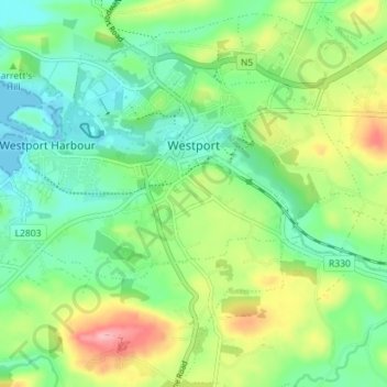
Name: Westport topographic map, elevation, terrain.
Location: Westport, County Mayo, Connacht, Ireland (53.77863 -9.56868 53.81099 -9.49792)
Average elevation: 44 m
Minimum elevation: -1 m
Maximum elevation: 130 m
Make a donation
Other topographic maps
Click on a map to view its topography, its elevation and its terrain.
Nephin
In Leabhar Fiachrach, a topographical and genealogical tract written by Giolla Iosa Mor Mac Fhirbhisigh about 1400, the areas early peoples and families are listed thus.
Average elevation: 404 m
Make a donation
Make a donation
Make a donation
Make a donation
Make a donation
Make a donation
Make a donation
Make a donation
Make a donation