
Thank you for supporting this site ❤️
Make a donation
Make a donation
Watertown topographic map
Click on the map to display elevation.
Thank you for supporting this site ❤️
Make a donation
Make a donation
Watertown
According to the United States Census Bureau, the city has a total area of 25.04 square miles (64.85 km2), of which 17.45 square miles (45.20 km2) is land and 7.59 square miles (19.66 km2) is water. Watertown sits on the Big Sioux River and two major lakes, Pelican Lake and Lake Kampeska. Most of Watertown also sits upon a short plateau. The elevation at Watertown Regional Airport is 1,745 feet.
Thank you for supporting this site ❤️
Make a donation
Make a donation
About this map
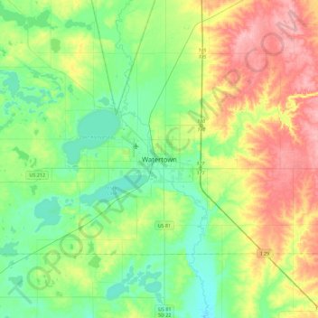
Name: Watertown topographic map, elevation, terrain.
Average elevation: 550 m
Minimum elevation: 512 m
Maximum elevation: 621 m
Thank you for supporting this site ❤️
Make a donation
Make a donation