
Nayarit topographic map
Interactive map
Click on the map to display elevation.
About this map
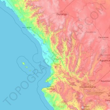
Name: Nayarit topographic map, elevation, terrain.
Location: Nayarit, México (19.44000 -107.56000 24.56000 -102.44000)
Average elevation: 1,039 m
Minimum elevation: -2 m
Maximum elevation: 3,964 m
Other topographic maps
Click on a map to view its topography, its elevation and its terrain.