
Mont-Royal topographic map
Interactive map
Click on the map to display elevation.
About this map
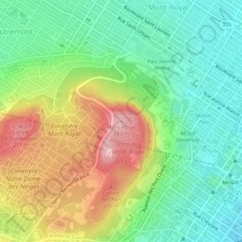
Name: Mont-Royal topographic map, elevation, terrain.
Average elevation: 111 m
Minimum elevation: 35 m
Maximum elevation: 232 m
De top van de Mont Royal wordt gemarkeerd door een verlicht kruis met een hoogte van 31 meter, dat werd opgericht in 1924. De heuvel en het kruis vormen samen een bekend beeldmerk van de stad Montreal.