
Thank you for supporting this site ❤️
Make a donation
Make a donation
Ban Nor Lae topographic map
Click on the map to display elevation.
Thank you for supporting this site ❤️
Make a donation
Make a donation
About this map
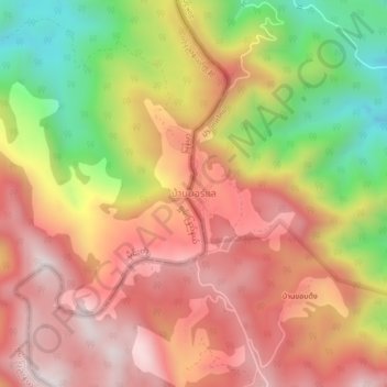
Name: Ban Nor Lae topographic map, elevation, terrain.
Location: Ban Nor Lae, Chiang Mai Province, Thailand (19.91728 99.02143 19.95728 99.06143)
Average elevation: 1,291 m
Minimum elevation: 829 m
Maximum elevation: 1,625 m
Thank you for supporting this site ❤️
Make a donation
Make a donation
Other topographic maps
Click on a map to view its topography, its elevation and its terrain.