
Quiroga topographic map
Interactive map
Click on the map to display elevation.
About this map
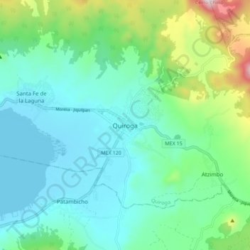
Name: Quiroga topographic map, elevation, terrain.
Location: Quiroga, Michoacán, 58420, México (19.62381 -101.56403 19.70381 -101.48403)
Average elevation: 2,202 m
Minimum elevation: 2,036 m
Maximum elevation: 2,788 m
Other topographic maps
Click on a map to view its topography, its elevation and its terrain.
San Jerónimo Purenchécuaro
México > Michoacán > Quiroga > San Jerónimo Purenchécuaro
San Jerónimo Purenchécuaro, Quiroga, Michoacán, 58430, México
Average elevation: 2,072 m