
Lichtentanne topographic map
Interactive map
Click on the map to display elevation.
About this map
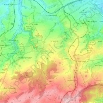
Name: Lichtentanne topographic map, elevation, terrain.
Location: Lichtentanne, Zwickau, Saxony, 08115, Germany (50.63627 12.37591 50.70832 12.46419)
Average elevation: 378 m
Minimum elevation: 286 m
Maximum elevation: 487 m