
Saguenay topographic map
Interactive map
Click on the map to display elevation.
About this map
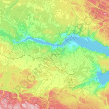
Name: Saguenay topographic map, elevation, terrain.
Location: Saguenay, Saguenay–Lac-Saint-Jean, Quebec, G7H 3A5, Canada (48.24596 -71.22918 48.56596 -70.90918)
Average elevation: 150 m
Minimum elevation: 0 m
Maximum elevation: 406 m