
Seja topographic map
Interactive map
Click on the map to display elevation.
About this map
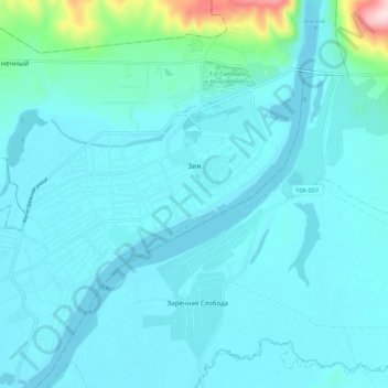
Name: Seja topographic map, elevation, terrain.
Average elevation: 248 m
Minimum elevation: 216 m
Maximum elevation: 520 m
Other topographic maps
Click on a map to view its topography, its elevation and its terrain.
Seja
Russland > Oblast Amur > городской округ Зея > Seja
Seja, городской округ Зея, Oblast Amur, Föderationskreis Ferner Osten, 676243, Russland
Average elevation: 272 m