
Thank you for supporting this site ❤️
Make a donation
Make a donation
Genteng topographic map
Click on the map to display elevation.
Thank you for supporting this site ❤️
Make a donation
Make a donation
About this map
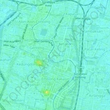
Name: Genteng topographic map, elevation, terrain.
Location: Genteng, Surabaya, East Java, Indonesia (-7.27734 112.73318 -7.24346 112.75331)
Average elevation: 6 m
Minimum elevation: 2 m
Maximum elevation: 18 m
Thank you for supporting this site ❤️
Make a donation
Make a donation