
São Bento das Peras topographic map
Interactive map
Click on the map to display elevation.
About this map
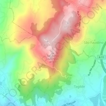
Name: São Bento das Peras topographic map, elevation, terrain.
Location: São Bento das Peras, Vizela, Braga, 4815-596, Portugal (41.38579 -8.28755 41.38589 -8.28745)
Average elevation: 289 m
Minimum elevation: 129 m
Maximum elevation: 471 m
Other topographic maps
Click on a map to view its topography, its elevation and its terrain.