
Thank you for supporting this site ❤️
Make a donation
Make a donation
Holly Springs topographic map
Click on the map to display elevation.
Thank you for supporting this site ❤️
Make a donation
Make a donation
About this map
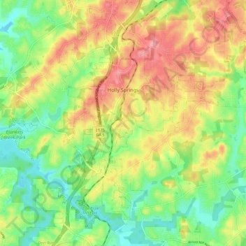
Name: Holly Springs topographic map, elevation, terrain.
Location: Holly Springs, Cherokee County, Georgia, United States (34.12462 -84.52751 34.19894 -84.41884)
Average elevation: 306 m
Minimum elevation: 254 m
Maximum elevation: 369 m
Thank you for supporting this site ❤️
Make a donation
Make a donation