Thank you for supporting this site ❤️
Make a donation
Make a donation
Gorran topographic map
Click on the map to display elevation.
Thank you for supporting this site ❤️
Make a donation
Make a donation
About this map
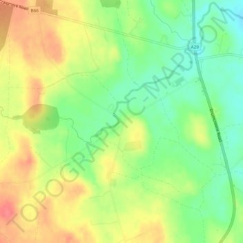
Name: Gorran topographic map, elevation, terrain.
Location: Gorran, Ulster, Northern Ireland, United Kingdom (55.01684 -6.71869 55.02762 -6.68551)
Average elevation: 83 m
Minimum elevation: 52 m
Maximum elevation: 116 m
Thank you for supporting this site ❤️
Make a donation
Make a donation
Other topographic maps
Click on a map to view its topography, its elevation and its terrain.
Derry/Londonderry
United Kingdom > Northern Ireland > County Londonderry
Derry is characterised by its distinctively hilly topography. The River Foyle forms a deep valley as it flows through the city, making Derry a place of very steep streets and sudden, startling views. The original walled city of Londonderry lies on a hill on the west bank of the River Foyle. In the past, the…
Average elevation: 88 m
Thank you for supporting this site ❤️
Make a donation
Make a donation
Thank you for supporting this site ❤️
Make a donation
Make a donation
Thank you for supporting this site ❤️
Make a donation
Make a donation
Thank you for supporting this site ❤️
Make a donation
Make a donation
Thank you for supporting this site ❤️
Make a donation
Make a donation
