
Igrejinha topographic map
Interactive map
Click on the map to display elevation.
About this map
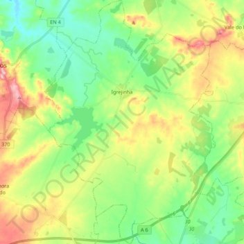
Name: Igrejinha topographic map, elevation, terrain.
Location: Igrejinha, Arraiolos, Évora, Portugal (38.62786 -7.95034 38.75723 -7.83440)
Average elevation: 281 m
Minimum elevation: 223 m
Maximum elevation: 381 m
Other topographic maps
Click on a map to view its topography, its elevation and its terrain.