
Kitchener topographic map
Interactive map
Click on the map to display elevation.
About this map
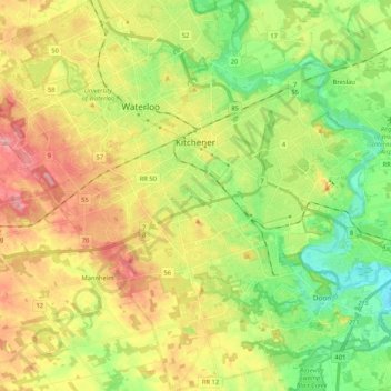
Name: Kitchener topographic map, elevation, terrain.
Average elevation: 336 m
Minimum elevation: 272 m
Maximum elevation: 419 m
Other topographic maps
Click on a map to view its topography, its elevation and its terrain.
Waterloo
Canada > Ontario > Region of Waterloo
Waterloo, Region of Waterloo, Ontario, Canada
Average elevation: 341 m