
Thank you for supporting this site ❤️
Make a donation
Make a donation
Tihiroa topographic map
Click on the map to display elevation.
Thank you for supporting this site ❤️
Make a donation
Make a donation
About this map
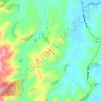
Name: Tihiroa topographic map, elevation, terrain.
Location: Tihiroa, Otorohanga District, Waikato, New Zealand (-38.12038 175.18166 -38.12028 175.18176)
Average elevation: 88 m
Minimum elevation: 32 m
Maximum elevation: 206 m
Otorohanga District trails, hiking, mountain biking, running and outdoor activities
Thank you for supporting this site ❤️
Make a donation
Make a donation