
Make a donation
Otaki topographic map
Click on the map to display elevation.
Make a donation
Otaki
Ōtaki is a landlocked town in the center of the Bōsō Peninsula, about 35 kilometers from the prefectural capital at Chiba and 60 to 70 kilometers from central Tokyo. The southwest area of Ōtaki is mountainous, with elevations gradually lowering towards the northeast of the town. Approximately 70% of Ōtaki is covered by forest. The Isumi River flows through the town to the northeast, and in the western part of the town the Yōrō River flows to the north. The town extends for about 12 kilometers east to west by about 19 kilometers north to south.
Make a donation
About this map
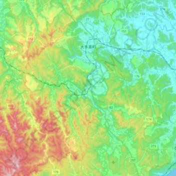
Name: Otaki topographic map, elevation, terrain.
Location: Otaki, Isumi, Chiba Prefecture, Japan (35.16556 140.13935 35.32729 140.28622)
Average elevation: 114 m
Minimum elevation: 0 m
Maximum elevation: 350 m
Make a donation