
Thank you for supporting this site ❤️
Make a donation
Make a donation
Digby County topographic map
Click on the map to display elevation.
Thank you for supporting this site ❤️
Make a donation
Make a donation
About this map
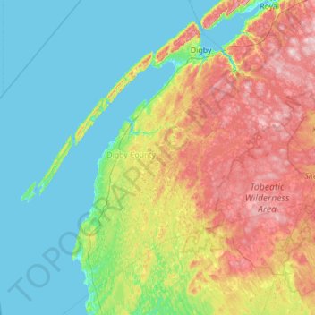
Name: Digby County topographic map, elevation, terrain.
Location: Digby County, Nova Scotia, Canada (43.83472 -66.68072 44.95666 -65.33217)
Average elevation: 54 m
Minimum elevation: -4 m
Maximum elevation: 266 m
Thank you for supporting this site ❤️
Make a donation
Make a donation