
Thank you for supporting this site ❤️
Make a donation
Make a donation
Hewitt topographic map
Click on the map to display elevation.
Thank you for supporting this site ❤️
Make a donation
Make a donation
About this map
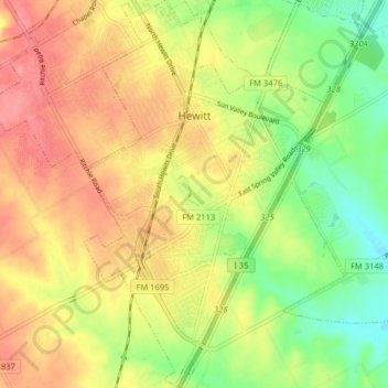
Name: Hewitt topographic map, elevation, terrain.
Location: Hewitt, McLennan County, Texas, 76643, United States (31.41429 -97.21849 31.48264 -97.16902)
Average elevation: 190 m
Minimum elevation: 150 m
Maximum elevation: 225 m
Thank you for supporting this site ❤️
Make a donation
Make a donation
Other topographic maps
Click on a map to view its topography, its elevation and its terrain.
Thank you for supporting this site ❤️
Make a donation
Make a donation
Northcrest
United States > Texas > McLennan County > Lacy-Lakeview > Northcrest
Average elevation: 149 m
Thank you for supporting this site ❤️
Make a donation
Make a donation