
Manso topographic map
Interactive map
Click on the map to display elevation.
About this map
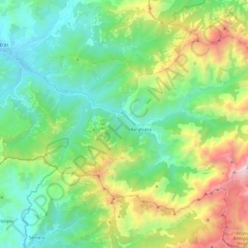
Name: Manso topographic map, elevation, terrain.
Average elevation: 735 m
Minimum elevation: 8 m
Maximum elevation: 2,516 m
Other topographic maps
Click on a map to view its topography, its elevation and its terrain.
Pianello
France > Corsica > Haute-Corse > Pianello
Pianello, Corte, Haute-Corse, Corsica, Metropolitan France, 20272, France
Average elevation: 951 m