
Thank you for supporting this site ❤️
Make a donation
Make a donation
Echague topographic map
Click on the map to display elevation.
Thank you for supporting this site ❤️
Make a donation
Make a donation
About this map
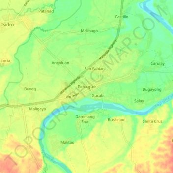
Name: Echague topographic map, elevation, terrain.
Location: Echague, Isabela, Cagayan Valley, 3309, Philippines (16.66536 121.63495 16.74536 121.71495)
Average elevation: 71 m
Minimum elevation: 48 m
Maximum elevation: 97 m
Thank you for supporting this site ❤️
Make a donation
Make a donation
Other topographic maps
Click on a map to view its topography, its elevation and its terrain.