
Red Lion topographic map
Interactive map
Click on the map to display elevation.
About this map
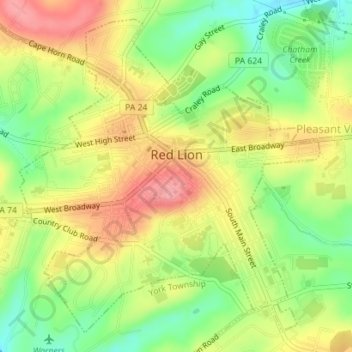
Name: Red Lion topographic map, elevation, terrain.
Location: Red Lion, York County, Pennsylvania, 17356, United States (39.88724 -76.62255 39.91130 -76.59148)
Average elevation: 262 m
Minimum elevation: 212 m
Maximum elevation: 309 m
Other topographic maps
Click on a map to view its topography, its elevation and its terrain.
East York
United States > Pennsylvania > York County > Springettsbury Township
Average elevation: 143 m
Pleasureville
United States > Pennsylvania > York County > Springettsbury Township
Average elevation: 145 m
Spring Plains
United States > Pennsylvania > York County > Springettsbury Township
Average elevation: 151 m
Delta Ridge
United States > Pennsylvania > York County > Peach Bottom Township
Average elevation: 150 m
Ore Valley
United States > Pennsylvania > York County > York Township > Ore Valley
Average elevation: 202 m