
Thank you for supporting this site ❤️
Make a donation
Make a donation
Placentia topographic map
Click on the map to display elevation.
Thank you for supporting this site ❤️
Make a donation
Make a donation
About this map
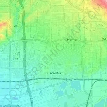
Name: Placentia topographic map, elevation, terrain.
Location: Placentia, Orange County, California, United States (33.85360 -117.88502 33.91020 -117.81644)
Average elevation: 87 m
Minimum elevation: 52 m
Maximum elevation: 184 m
Thank you for supporting this site ❤️
Make a donation
Make a donation
Other topographic maps
Click on a map to view its topography, its elevation and its terrain.