
Thank you for supporting this site ❤️
Make a donation
Make a donation
Bakersfield topographic map
Click on the map to display elevation.
Thank you for supporting this site ❤️
Make a donation
Make a donation
Bakersfield
Most of Bakersfield's major streets are six-lane divided roads with bike lanes, with most streets in the city having proper lane signage for bicycle traffic but little to no protection from vehicle traffic. Despite the city's relatively flat topography and grid-like street system, only around 2,782 bike commuters exist, as estimated in 2013, around 0.7% of its total population then.
Thank you for supporting this site ❤️
Make a donation
Make a donation
About this map
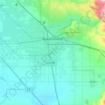
Name: Bakersfield topographic map, elevation, terrain.
Location: Bakersfield, Kern County, California, United States (35.19398 -119.26503 35.44730 -118.77234)
Average elevation: 157 m
Minimum elevation: 81 m
Maximum elevation: 915 m
Thank you for supporting this site ❤️
Make a donation
Make a donation
Other topographic maps
Click on a map to view its topography, its elevation and its terrain.