
Thank you for supporting this site ❤️
Make a donation
Make a donation
Llanilar topographic map
Click on the map to display elevation.
Thank you for supporting this site ❤️
Make a donation
Make a donation
About this map
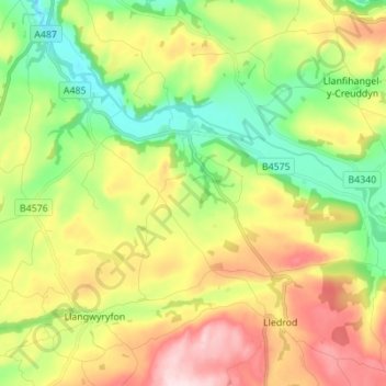
Name: Llanilar topographic map, elevation, terrain.
Location: Llanilar, Ceredigion, Wales, United Kingdom (52.31745 -4.09242 52.36897 -3.95455)
Average elevation: 148 m
Minimum elevation: 10 m
Maximum elevation: 340 m
Thank you for supporting this site ❤️
Make a donation
Make a donation
Other topographic maps
Click on a map to view its topography, its elevation and its terrain.