
Hat Chao Samran topographic map
Interactive map
Click on the map to display elevation.
About this map
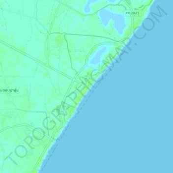
Name: Hat Chao Samran topographic map, elevation, terrain.
Location: Hat Chao Samran, Nong Khanan, Phetchaburi Province, Thailand (12.96595 100.02384 13.04595 100.10384)
Average elevation: 2 m
Minimum elevation: -1 m
Maximum elevation: 10 m