
Khujand topographic map
Interactive map
Click on the map to display elevation.
About this map
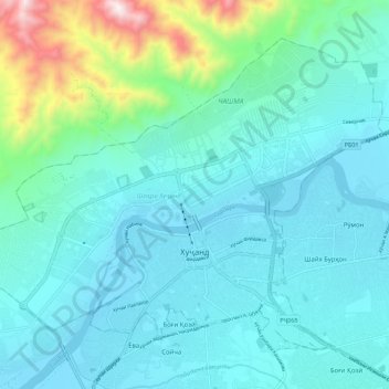
Name: Khujand topographic map, elevation, terrain.
Location: Khujand, Sughd Region, Tajikistan (40.26239 69.56125 40.33168 69.67407)
Average elevation: 465 m
Minimum elevation: 319 m
Maximum elevation: 1,229 m