
Thank you for supporting this site ❤️
Make a donation
Make a donation
Roby topographic map
Click on the map to display elevation.
Thank you for supporting this site ❤️
Make a donation
Make a donation
About this map
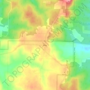
Name: Roby topographic map, elevation, terrain.
Location: Roby, Texas County, Missouri, 65557, United States (37.49560 -92.15905 37.53560 -92.11905)
Average elevation: 403 m
Minimum elevation: 354 m
Maximum elevation: 449 m
Thank you for supporting this site ❤️
Make a donation
Make a donation
Other topographic maps
Click on a map to view its topography, its elevation and its terrain.