
Le Cruchet topographic map
Interactive map
Click on the map to display elevation.
About this map
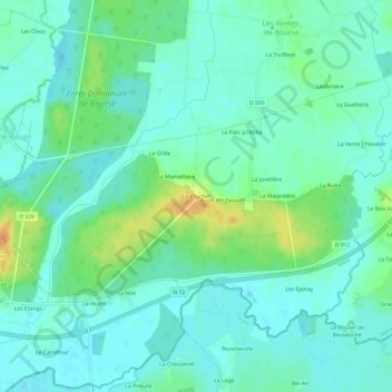
Name: Le Cruchet topographic map, elevation, terrain.
Location: Le Cruchet, Alençon, Orne, Normandy, Metropolitan France, France (48.47353 0.24371 48.51353 0.28371)
Average elevation: 144 m
Minimum elevation: 134 m
Maximum elevation: 170 m