
Newton County topographic map
Interactive map
Click on the map to display elevation.
About this map
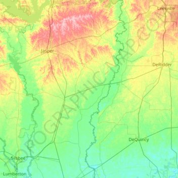
Name: Newton County topographic map, elevation, terrain.
Location: Newton County, Texas, United States of America (30.24191 -93.91107 31.18957 -93.50782)
Average elevation: 43 m
Minimum elevation: -1 m
Maximum elevation: 179 m
Other topographic maps
Click on a map to view its topography, its elevation and its terrain.
Lake Medina Highlands
United States of America > Texas > Lakehills > Lake Medina Highlands
Average elevation: 344 m