
Mataura topographic map
Interactive map
Click on the map to display elevation.
About this map
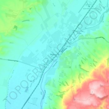
Name: Mataura topographic map, elevation, terrain.
Location: Mataura, Gore District, Southland, 9712, New Zealand (-46.23273 168.82427 -46.15273 168.90427)
Average elevation: 105 m
Minimum elevation: 38 m
Maximum elevation: 336 m
Gore District trails, hiking, mountain biking, running and outdoor activities