
Thank you for supporting this site ❤️
Make a donation
Make a donation
Frégate Island topographic map
Click on the map to display elevation.
Thank you for supporting this site ❤️
Make a donation
Make a donation
Frégate Island
The highest point on the island is Mount Signal in the central west area of the island, which has an elevation of 125 metres (410 feet). The Riviére Bambous flows from approximately 300 metres north-east of the mountain where it flows down past the Gros Bois Noire and Plaine Magnan areas of the northern inner island and then acutely northeast until it reaches the Indian Ocean north of the airstrip on the east coast.
Thank you for supporting this site ❤️
Make a donation
Make a donation
About this map
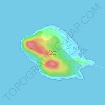
Name: Frégate Island topographic map, elevation, terrain.
Location: Frégate Island, La Digue District, La Digue Group, Seychelles (-4.59304 55.93187 -4.57872 55.95137)
Average elevation: 10 m
Minimum elevation: -1 m
Maximum elevation: 117 m
Thank you for supporting this site ❤️
Make a donation
Make a donation