
Lake Rotoiti / Te Roto kite ā Ihenga i ariki ai Kahu topographic map
Interactive map
Click on the map to display elevation.
About this map
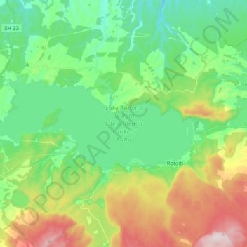
Name: Lake Rotoiti / Te Roto kite ā Ihenga i ariki ai Kahu topographic map, elevation, terrain.
Average elevation: 375 m
Minimum elevation: 177 m
Maximum elevation: 796 m