Big Bay topographic map
Interactive map
Click on the map to display elevation.
About this map
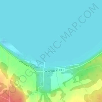
Name: Big Bay topographic map, elevation, terrain.
Location: Big Bay, Georgian Bluffs, Grey County, Ontario, Canada (44.79679 -80.94523 44.79689 -80.94513)
Average elevation: 186 m
Minimum elevation: 172 m
Maximum elevation: 238 m
Other topographic maps
Click on a map to view its topography, its elevation and its terrain.
Kilsyth
Canada > Ontario > Grey County > Georgian Bluffs
Kilsyth, Georgian Bluffs, Grey County, Ontario, N4K 5N5, Canada
Average elevation: 256 m
Bruce Peninsula
Canada > Ontario > Grey County > Georgian Bluffs
Bruce Peninsula, Georgian Bluffs, Grey County, Southwestern Ontario, Ontario, N4K 5N4, Canada
Average elevation: 240 m
Kemble
Canada > Ontario > Grey County > Georgian Bluffs
Kemble, Georgian Bluffs, Grey County, Ontario, Canada
Average elevation: 243 m
Jones Falls
Canada > Ontario > Grey County > Georgian Bluffs
Jones Falls, Georgian Bluffs, Grey County, Southwestern Ontario, Ontario, N4K 5P7, Canada
Average elevation: 236 m