
Ruru topographic map
Click on the map to display elevation.
About this map
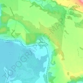
Name: Ruru topographic map, elevation, terrain.
Location: Ruru, Moana, Grey District, West Coast, 7845, New Zealand (-42.59744 171.48066 -42.55744 171.52066)
Average elevation: 124 m
Minimum elevation: 84 m
Maximum elevation: 214 m
New Zealand trails, hiking, mountain biking, running and outdoor activities