
Thank you for supporting this site ❤️
Make a donation
Make a donation
Santiago 2 topographic map
Click on the map to display elevation.
Thank you for supporting this site ❤️
Make a donation
Make a donation
About this map
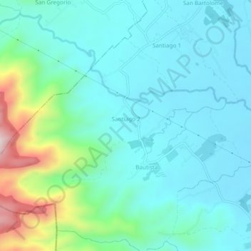
Name: Santiago 2 topographic map, elevation, terrain.
Location: Santiago 2, San Pablo, Laguna, Calabarzon, 4000, Philippines (13.98843 121.24450 14.02152 121.29297)
Average elevation: 168 m
Minimum elevation: 56 m
Maximum elevation: 614 m
Thank you for supporting this site ❤️
Make a donation
Make a donation
Other topographic maps
Click on a map to view its topography, its elevation and its terrain.