
Thank you for supporting this site ❤️
Make a donation
Make a donation
Ban Mae Aen topographic map
Click on the map to display elevation.
Thank you for supporting this site ❤️
Make a donation
Make a donation
About this map
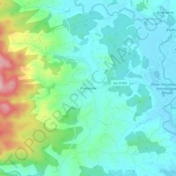
Name: Ban Mae Aen topographic map, elevation, terrain.
Location: Ban Mae Aen, Rim Nuea, Mae Rim, Chiang Mai Province, Thailand (18.94577 98.87668 18.98577 98.91668)
Average elevation: 385 m
Minimum elevation: 329 m
Maximum elevation: 557 m
Thank you for supporting this site ❤️
Make a donation
Make a donation