
Thank you for supporting this site ❤️
Make a donation
Make a donation
Frontier County topographic map
Click on the map to display elevation.
Thank you for supporting this site ❤️
Make a donation
Make a donation
About this map
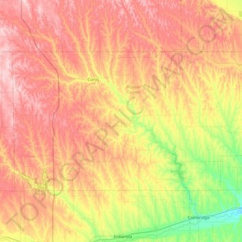
Name: Frontier County topographic map, elevation, terrain.
Location: Frontier County, Nebraska, United States (40.34876 -100.78350 40.70038 -99.98162)
Average elevation: 815 m
Minimum elevation: 673 m
Maximum elevation: 962 m
Thank you for supporting this site ❤️
Make a donation
Make a donation
Other topographic maps
Click on a map to view its topography, its elevation and its terrain.