
Thank you for supporting this site ❤️
Make a donation
Make a donation
Orton topographic map
Click on the map to display elevation.
Thank you for supporting this site ❤️
Make a donation
Make a donation
About this map
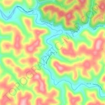
Name: Orton topographic map, elevation, terrain.
Location: Orton, Gilmer County, West Virginia, 25267, United States (38.81509 -80.94844 38.85509 -80.90844)
Average elevation: 303 m
Minimum elevation: 215 m
Maximum elevation: 393 m
Thank you for supporting this site ❤️
Make a donation
Make a donation
Other topographic maps
Click on a map to view its topography, its elevation and its terrain.