
Thank you for supporting this site ❤️
Make a donation
Make a donation
Zuehl topographic map
Click on the map to display elevation.
Thank you for supporting this site ❤️
Make a donation
Make a donation
About this map
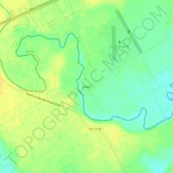
Name: Zuehl topographic map, elevation, terrain.
Location: Zuehl, Guadalupe County, Texas, United States (29.46551 -98.18612 29.50551 -98.14612)
Average elevation: 183 m
Minimum elevation: 169 m
Maximum elevation: 197 m
Thank you for supporting this site ❤️
Make a donation
Make a donation
Other topographic maps
Click on a map to view its topography, its elevation and its terrain.