
Thank you for supporting this site ❤️
Make a donation
Make a donation
Virgil topographic map
Click on the map to display elevation.
Thank you for supporting this site ❤️
Make a donation
Make a donation
About this map
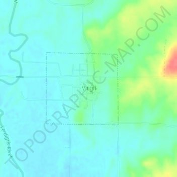
Name: Virgil topographic map, elevation, terrain.
Location: Virgil, Greenwood County, Kansas, 66870, United States (37.97522 -96.01852 37.98624 -96.00460)
Average elevation: 309 m
Minimum elevation: 295 m
Maximum elevation: 355 m
Thank you for supporting this site ❤️
Make a donation
Make a donation
Other topographic maps
Click on a map to view its topography, its elevation and its terrain.