
Stallham topographic map
Interactive map
Click on the map to display elevation.
About this map
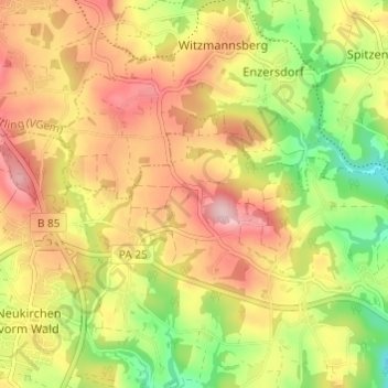
Name: Stallham topographic map, elevation, terrain.
Average elevation: 463 m
Minimum elevation: 356 m
Maximum elevation: 556 m
Other topographic maps
Click on a map to view its topography, its elevation and its terrain.
Götzendorf
Deutschland > Bayern > Landkreis Passau > Neukirchen vorm Wald
Götzendorf, Neukirchen vorm Wald, Landkreis Passau, Bayern, 94154, Deutschland
Average elevation: 427 m