
Thank you for supporting this site ❤️
Make a donation
Make a donation
Allouez topographic map
Click on the map to display elevation.
Thank you for supporting this site ❤️
Make a donation
Make a donation
About this map
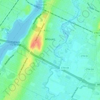
Name: Allouez topographic map, elevation, terrain.
Location: Allouez, Brown County, Wisconsin, 54301, United States (44.44508 -88.05560 44.49816 -87.99714)
Average elevation: 185 m
Minimum elevation: 176 m
Maximum elevation: 215 m
Thank you for supporting this site ❤️
Make a donation
Make a donation
Other topographic maps
Click on a map to view its topography, its elevation and its terrain.
Depere Lock and Dam
United States > Wisconsin > Brown County > De Pere > West De Pere
Average elevation: 186 m
Thank you for supporting this site ❤️
Make a donation
Make a donation
Thank you for supporting this site ❤️
Make a donation
Make a donation