
Thank you for supporting this site ❤️
Make a donation
Make a donation
Rodney topographic map
Click on the map to display elevation.
Thank you for supporting this site ❤️
Make a donation
Make a donation
About this map
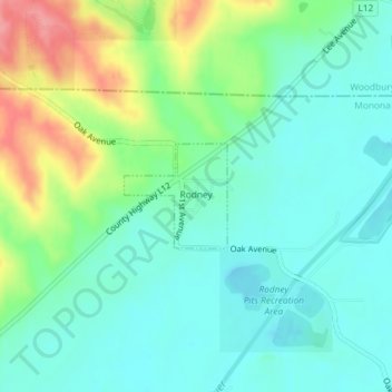
Name: Rodney topographic map, elevation, terrain.
Location: Rodney, Monona County, Iowa, United States (42.20077 -95.95729 42.20801 -95.94769)
Average elevation: 343 m
Minimum elevation: 315 m
Maximum elevation: 408 m
Thank you for supporting this site ❤️
Make a donation
Make a donation