
Thank you for supporting this site ❤️
Make a donation
Make a donation
Bonvilston topographic map
Click on the map to display elevation.
Thank you for supporting this site ❤️
Make a donation
Make a donation
Bonvilston
In the 19th century, Richard Bassett, a prominent figure in Glamorgan resided at Bonvilston House and owned the manor. The 1811 A Topographical Dictionary of The Dominion of Wales by Nicholas Carlisle said of the village.
Thank you for supporting this site ❤️
Make a donation
Make a donation
About this map
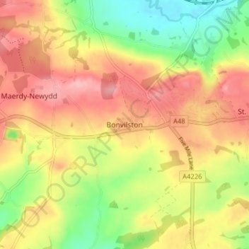
Name: Bonvilston topographic map, elevation, terrain.
Location: Bonvilston, Vale of Glamorgan, Wales, CF5 6TY, United Kingdom (51.43855 -3.36566 51.47855 -3.32566)
Average elevation: 83 m
Minimum elevation: 17 m
Maximum elevation: 137 m
Thank you for supporting this site ❤️
Make a donation
Make a donation
Other topographic maps
Click on a map to view its topography, its elevation and its terrain.