
Thank you for supporting this site ❤️
Make a donation
Make a donation
Le Pont topographic map
Click on the map to display elevation.
Thank you for supporting this site ❤️
Make a donation
Make a donation
About this map
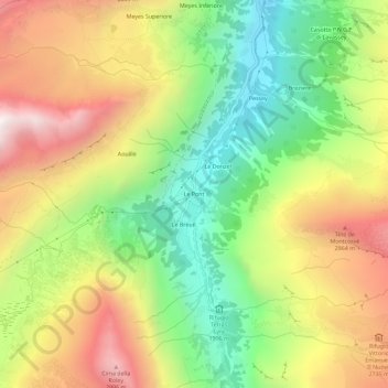
Name: Le Pont topographic map, elevation, terrain.
Location: Le Pont, Valsavarenche, Aosta Valley, Italy (45.50746 7.18237 45.54746 7.22237)
Average elevation: 2,410 m
Minimum elevation: 1,812 m
Maximum elevation: 3,114 m
Thank you for supporting this site ❤️
Make a donation
Make a donation