
Thank you for supporting this site ❤️
Make a donation
Make a donation
St Cyrus topographic map
Click on the map to display elevation.
Thank you for supporting this site ❤️
Make a donation
Make a donation
About this map
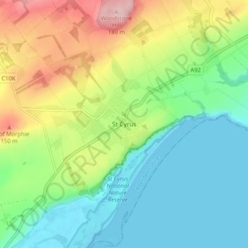
Name: St Cyrus topographic map, elevation, terrain.
Location: St Cyrus, Aberdeenshire, Scotland, DD10 0BG, United Kingdom (56.75428 -2.43591 56.79428 -2.39591)
Average elevation: 63 m
Minimum elevation: -1 m
Maximum elevation: 186 m
Thank you for supporting this site ❤️
Make a donation
Make a donation
Other topographic maps
Click on a map to view its topography, its elevation and its terrain.