
Nakajima Island topographic map
Interactive map
Click on the map to display elevation.
About this map
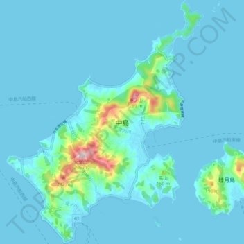
Name: Nakajima Island topographic map, elevation, terrain.
Location: Nakajima Island, Matsuyama, Ehime Prefecture, Japan (33.94273 132.57788 34.01851 132.65253)
Average elevation: 24 m
Minimum elevation: 0 m
Maximum elevation: 285 m
Other topographic maps
Click on a map to view its topography, its elevation and its terrain.